Perito Moreno National Park: complete guide to the park that is not the glacier
Destination guide · Updated November 2026 · By Centinela Explora, organizing treks in the park since 2025
In a nutshell
Perito Moreno National Park is in northwestern Santa Cruz, Argentina, about 220 km from Gobernador Gregores, and it is not where the Perito Moreno Glacier is: that glacier is in Los Glaciares National Park, near El Calafate. It is one of the least visited parks in Argentina, with turquoise lakes, steppe, Andean forest and glaciers flowing down from Cerro San Lorenzo. It is open from October 1 to April 30, it is explored on foot sleeping in mountain huts, and you are very likely to see guanacos and lesser rheas; pumas live here, but seeing one is not guaranteed.
Quick facts
| Location | Northwestern Santa Cruz province, in the Andes, on the border with Chile |
|---|---|
| Getting there | From Gobernador Gregores, about 220 km on National Route 40 and Provincial Route 37; the last stretch is gravel |
| Season | October 1 to April 30 |
| Recommended stay | At least 4 or 5 days inside the park to hike the main circuits |
| What you will see | Lakes Belgrano and Burmeister, Laguna de los Témpanos, Cerro San Lorenzo, guanacos, lesser rheas, condors |
| Difficulty | Moderate to high depending on the trail |
| Where to sleep | Mountain huts and campsites, booked in advance at trekkingpnpm.com |
| Services | No shops, fuel stations or tire repair inside the park |
Is the Perito Moreno Glacier in Perito Moreno National Park?
No. This is the most common mix-up. The Perito Moreno Glacier is in Los Glaciares National Park, 80 km from El Calafate. Perito Moreno National Park is a different park, created in 1937, about 600 km north by road. It covers 142,120 hectares: about 127,000 of national park and 15,000 of the El Rincón Wildlife Reserve (Reserva Natural Silvestre), added later. Both are named after Francisco Pascasio Moreno, the "Perito", an explorer of Patagonia.
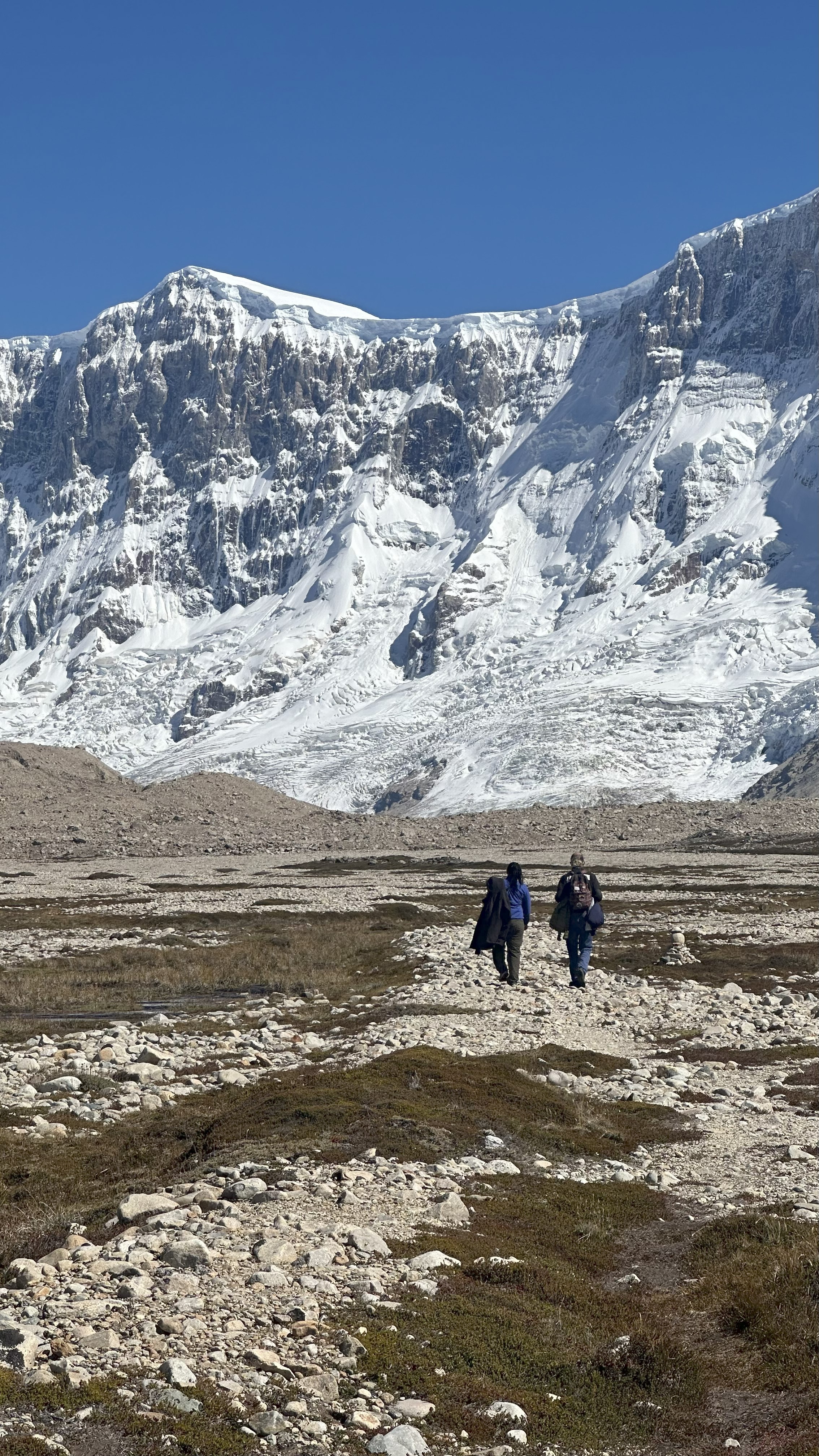
The park has glaciers too. The most visible ones flow down from Cerro San Lorenzo (3,706 m, the highest peak in Santa Cruz), on the park boundary: the glacier that reaches Laguna de los Témpanos calves blocks of ice that float on the water. Unlike the glacier near El Calafate, here you get there on foot, with almost no one around.
What wildlife can you see in Perito Moreno National Park?
Wildlife is one of the reasons to go. According to the park's Management Plan, the large herbivores are the guanaco and the huemul (South Andean deer), and the puma is the main predator.
- Almost certain: guanacos, seen on the steppe and hillsides throughout the trip.
- Very likely: lesser rheas (choiques), condors, foxes and lake birds such as upland geese. The lesser rhea is the largest bird of the steppe and the only rhea species recorded in the park's management plan.
- Possible, not guaranteed: the puma. It lives in the park, which has very few people, but it is an elusive animal.
- Exceptional: the huemul, an endangered deer and Argentine National Natural Monument. The park is one of its strongholds, but it is very rarely seen.
Where can you see pumas in Argentina?
Pumas live across most of Patagonia, but they are seen more often where there are few people and plenty of prey. Perito Moreno National Park has both: large guanaco populations and very few visitors. That makes it one of the places where an encounter is possible, although no one can guarantee it. Your best chances are early in the morning and at dusk, walking quietly and watching for tracks in mud and snow.
How difficult are the trails?
Officially, the park's trails are rated high difficulty. That rating mainly reflects that they are in a remote area, far from any help. In practice, each circuit is different:
- Península Belgrano: moderate. About 16.8 km (or 9.6 km with a shortcut), without major elevation changes, with views of Lake Belgrano. It is the longest day.
- Río Lácteo Valley: 11.5 km with only two noticeable climbs. It follows the river up to the Tompkins hut.
- Laguna de los Témpanos: the hard part is fording the Río Lácteo. From the hut it is about 5.2 km, but you have to wade across the river. Depending on the day's flow, the water can reach your knees, and it is very cold.
You do not need to be a mountaineer, but you should be used to walking several hours on natural terrain, with hiking boots and windproof clothing.
What are the mountain huts like?

They are simple mountain huts. They have insulating sleeping mats, a wood stove for heating and water containers for drinking and cooking water. Sometimes there is some cookware, like a kettle or a pot, but it is not guaranteed: bring your own. You need to bring a sleeping bag, food and everything to cook, and book the huts in advance on the official booking website, trekkingpnpm.com.
Can you make a fire?
Not outside the huts: open fires are prohibited throughout the park. Inside the huts, the only fire allowed is the wood stove, for heating. To cook, bring a camping stove and gas canister.
Is there a shop or anywhere to buy food?
Not inside the park. You need to bring all the food for your trekking days. At Estancia La Oriental, in the park area, you can buy a few basic items, but do not count on it to stock up.
When can you visit?
The official season runs from October 1 to April 30. December and January have the longest days; November tends to be windier and quieter, and February closes the high season with good conditions.
Keep in mind the start of the season: the park being open does not mean every trail is open. In the 2025-2026 season, the Río Lácteo Valley trail, which is higher and had received more snow, was badly damaged and only reopened around January. In the 2026-2027 season something similar happened: the opening planned for October was postponed because of snowfall and only began in November.
If you plan to go in October or November, follow the official social media of Perito Moreno National Park, where each year's open sectors are announced.
How do you get to the park?
There is no public transport to the park: you get there by car or on an organized trip that includes transfers. The most common access is from Gobernador Gregores, about 220 km on National Route 40 and Provincial Route 37, with the last stretch on gravel. If you go on your own:
- Two spare tires. The gravel roads are long and getting more than one flat is common.
- An extra jerrycan of fuel. Coming from the south, the last gas station is in Gobernador Gregores. Coming from the north, it is in the town of Perito Moreno; Bajo Caracoles has a pump, but it does not always have fuel.
- Arrive in daylight. National Parks recommends planning to reach your hut or campsite before dark.
- Register on arrival. Visitor registration is mandatory.
What we saw
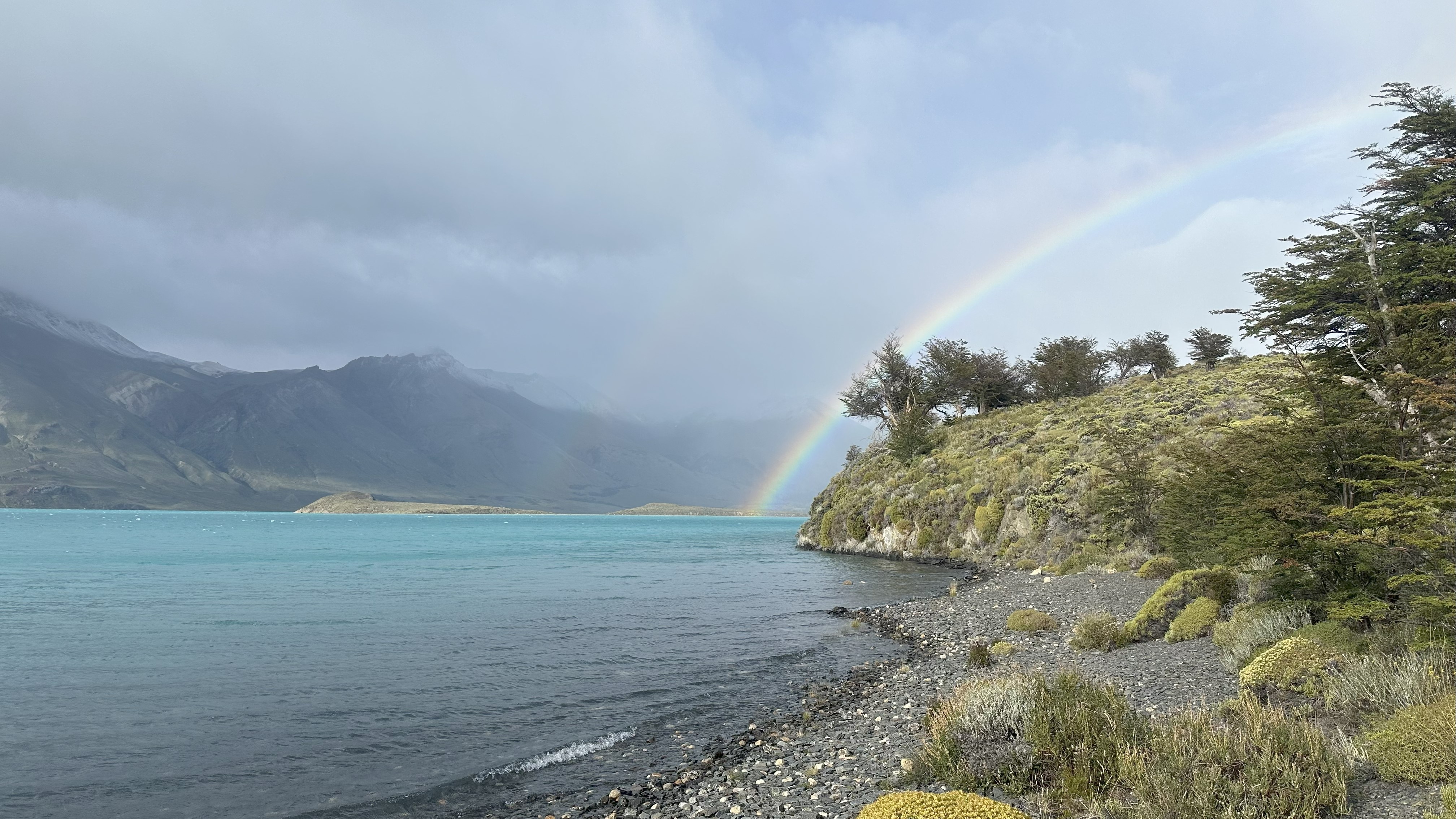
In February 2025 we led our first trekking expedition through the park, with a small group and sleeping in mountain huts. Fording the Río Lácteo was the hardest part on the way in, since we had just started walking. On the way back, after so many kilometers, putting our feet in the cold water was almost a relief. Read the chronicle of that trip.
If you want to travel with everything organized
If you want to travel with everything organized, check out our group departures.
We also organize private trips from El Calafate or Río Gallegos